Name
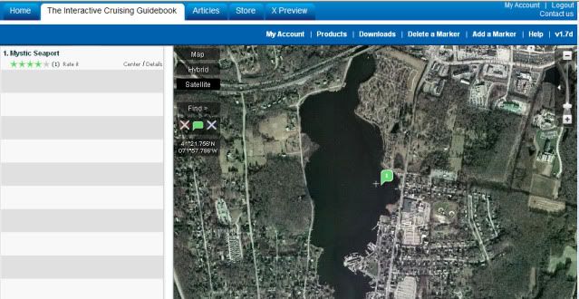
Mystic Seaport
Position
Latitude: 41°21.941'N
Longitude: 071°57.852'W
Description
Anchor on east side by the last green channel marker. Bottom shoals very quickly to the west. Good protection from wind. Close to seaport dinghy dock. After landing at seaport go to ticket entrance to get sticker. Only room for 3 or 4 boats. Good choice when seaport docks are full or to hide from weather.
Approach
No approach information given
Typical tide: No tide information given
Internet access
No internet access information given
Pets
No pet information given
Average ratings compiled from 1 rating
4: Overall rating (good)
4: Current protection (good)
5: Holding (excellent)
4: Wind protection (good)
5: Wake protection (excellent)
5: Scenery quality (excellent)
5: Shopping facilities (excellent)
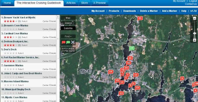
This info from the Active Captain site.
http://www.activecaptain.com/OTW.php
I personally have been there twice and my guess is you'd be lucky to find room.
You might poke around the Active Captain site to see Marina Facilities and call a few to see if they have slips or what they recommend.
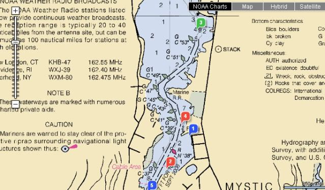
OH, and you can see these places on a NOAA chart too.
And it's all available on a smartphone as well...which you can use for live navigation if your phone is GPS equipped.
I like the satellite view to check out accessibility, floating docks and parking for boat ramps away from home that I've never been to.